This website uses cookies

Royal Danish Academy – Architecture, Design, Conservation uses cookies to create a better user experience, to interact with social platforms and for anonymised statistics of traffic on our website.

Social media cookies enable us to interact with well-known social media platforms and content. This may be for statistical or marketing reasons.
Neccesary to display YouTube videos
Neccesary to display Vimeo videos
Preference cookies enable a website to remember information that changes the way the website behaves or looks, like your preferred language or the region that you are in.
Is used for UI states

Mutated Landscape

Name
Sophie Daugaard Andersen
Education degree
Master
Subject area
Architecture
Study programme
Political Architecture: Critical Sustainability
Institute
Architecture and Culture
Year
2016

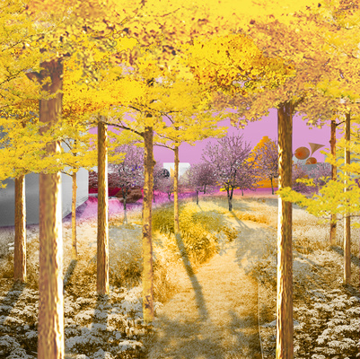
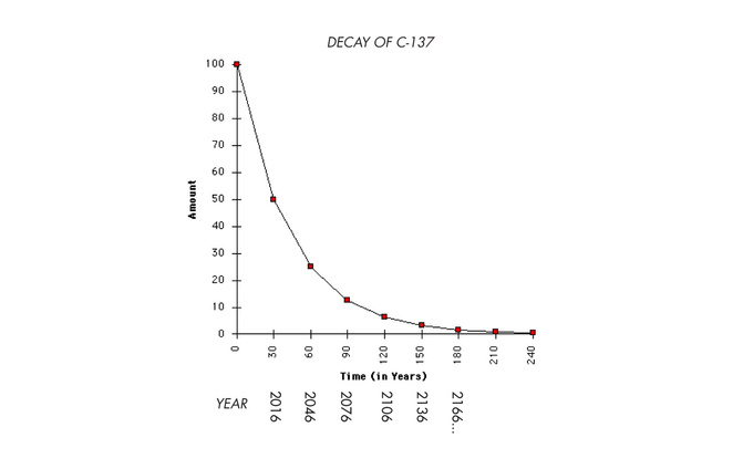
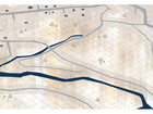
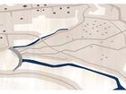
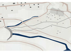
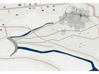
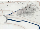
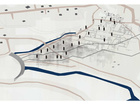
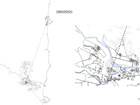
The project explores the flows of radioactive material in the landscape of Fukushima, Japan. This material is constantly migrating: Naturally by nature's dispersion through forests and rivers, and artificially by the operation of decontamination which involves removal of the top soil and storing it.
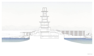
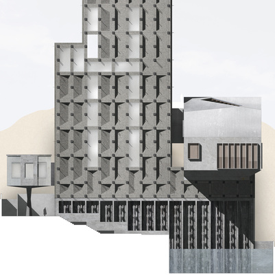
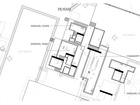
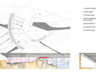
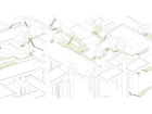
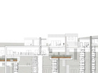
   By challenging the problematic of temporarily storing the soil a new way of inhabitation is proposed. Manipulating the site condition is done through an architecture that enables not only inhabitation but cultivation of the land, as well as creates a sustainable future for the community.

Section 1:200 of rice terrace community founded on concrete pillars constructed from bag formwork.
1:500 plan of future community development. Bags are still present in the North end while gradually removed from the South end.

The project is based on a field trip to Fukushima, Japan.

In March 2011 the Great Tohoku earthquake and tsunami hit the Northeastern coast of Japan and swept away the lives of more than 15,000 people.

On the Fukushima coast, the Daiichi nuclear power plant was inundated by the tsunami waves which destroyed the reactors' cooling systems and led to several meltdowns and hydrogen explosions.

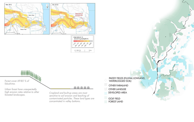
Radioactive material was thus dispersed across the Fukushima landscape and forced people as far as 60 kilometres from the plant to evacuate.

Fukushima became an anti-landscape, hostile to human inhabitation with zones and fenced off areas, abandonment and decay. 

1/6
Fukushima prefecture | Map showing the wind patterns after the Daiichi nuclear disaster dispersing radioactive material.
The development of official zonings around the Daiichi powerplant: Green, yellow, red. Red is for never return.
The contrast between the highlands and the flat coastal plains of Fukushima. The two nuclear power plants are shown
Field trip route and geiger counter measurements.
The current condition of the Fukushima landscape.
A view of Tomioka's temporary bag storage.

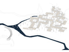
The final proposal is informed by research on three topics: Decontamination (artificial waste migration), sedimentation (natural waste migration) and deposition.


1/7
Decontamination workers meticulously removing top soil etc. from roofs and areas within 20 metres of roads.
Google Map collage of different stages in landscape development caused by the disaster.
Bag migration map. The bags are transported from the municipalities to the Daiichi Centre.
The current, official storage solution at Daiichi.
The bags as the unapproachable, the holy centre.

To be continued...