Veil
The project restores natural and historical values of an abandoned landscape of dunes and WWII bunkers. It brings forward traces of the past while fighting erosion. Its architecture is resilient and works with nature—in contrast with our current building culture. Parametrical tools and reusable components helps the project to be highly aware of its context as well as dynamically changing with it.

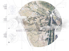
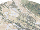
SITE
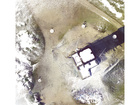
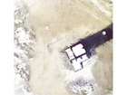
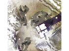
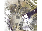
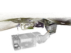
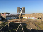
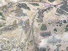
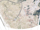
The Bego, France
The Bego, located in South Brittany in France, is a landscape of dunes embedded by WWII bunkers. Abandoned, after being hated, destroyed, and ignored, the bunkers are highly contested. When some people claim that they are unsafe and need to be erased, other affirm their historical value as well as the specific biodiversity they have brought to the dunes.


APPROACH
Working with nature
With this project the “Bego" was approached with the idea of an architecture that could be closer to nature, working with it and not against it. This vision coupled with research of textile logic systems—which have the potential to provide an architecture of flexible, synergic and porous structures—brought me to imagine a geotextile that would protect and support the nature of the dunes and the bunkers as well as display them. Additionally, the project seeks to reconcile both enemies and friends of the bunkers by increasing the safety of interactions for pedestrians around the bunkers as well as displaying past and present values of the “Bego”.


PROGRAM
Protecting & displaying
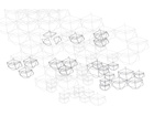
From these circumstances, the proposed program of the architecture is imagined as a museum with its two main qualities of protecting and displaying. Instead of a strong building showcasing a collection of foreign objects, this museum merges to the artefacts of its site: the bunkers and flora and fauna of the dunes. It adapts to these last ones over time, being an ephemeral natural “collection” of the site. The museum embodied as a component-based, fluid, lightweight surface scaffold, has gradient functions built into the components to achieve a symbiosis with its environment protecting the existing nature as well as encouraging new growth and modulating human interaction.
The project tells the story of the encounter and synergy of a natural soil with a manufactured one.


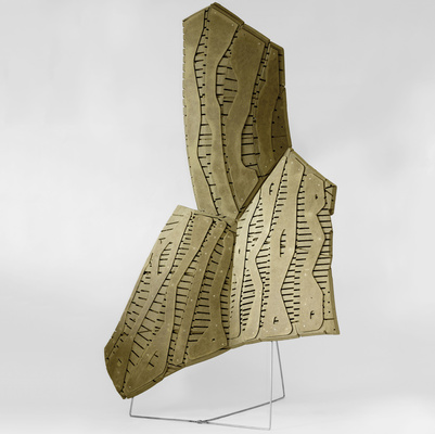
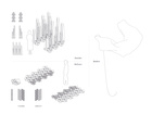
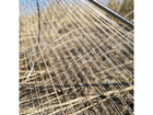
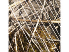
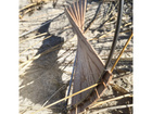
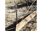
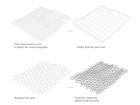
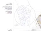
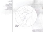
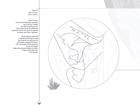
COMPONENTS
Microclimates & history
They are different components for different fonctions.
Some are ephemeral. They exist to fight against erosion mainly by slowing down the wind and retaining the sand but they also create microclimates to foster a diversity of flora and fauna. To achieve these microclimates the components are dressed in different ways: as an example, some have cotton string on them, retaining the water; others have wooden slates, creating shadows and sheltering from flying sand.
Some are permanent. They exist to remind us of the history of the site, which used to be a WWII battery. They are symbols. Some represent the trenches by creating a barrier, others represent the railways or signal the existence of a bunker.


EXPERIENCES
Going through the project reveals 3 different types of experiences/routes:
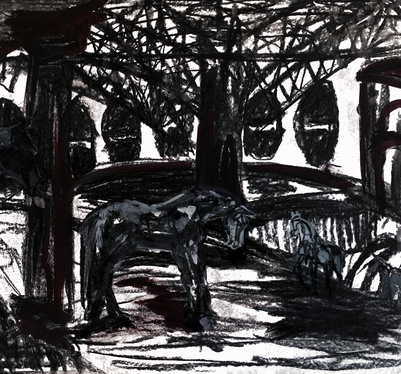
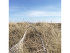
Horizon
The Bego was built to attack enemies that would be coming from the sea. It gathers a series of bunkers pointing towards the sea and attack oriented infrastructures such as canons, the fire control tower, the command post, the ammunitions depot, the railways. The project creates a route through them, enabling a clearer reading of this side of the site. This experience is also closely connected to the “horizon revealing” quality of the grey dune (no tree and flat land).


Underground
This route highlights the defensive and protective systems of the site. Following it leads you to a series of underground bunkers and protective infrastructures such as the shelters and the trenches. Choosing this path is also choosing to discover the new underground flora and fauna that the bunkers brought to the dunes as well as the dense trees situated between the site and the city.


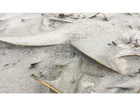
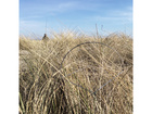
Surface
The project also underlines the fragile “surface” of the dunes: a flora in constant search for its balance, without deep roots. This layer protects and plays with the surface of the grey dune and its eroded parts. Constantly changing with the weather conditions, the visitor amounts and the flora itself, it offers a new experience of the site from one year to another.


PARAMETRIC APPROACH
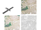
Data management for an architecture more aware of its context
One of my objectives with this project is to show how parametric tools can be used to try and develop an architecture more aware of its environnement.
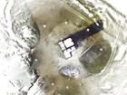
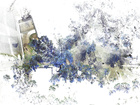
In this project, an algorithmic digital tool helps to create, handle and maintain this adaptable design. By automatically analysing 3D scans and aerial pictures as well as following design instructions given by the architect, the tool lays down the different components where they fit. It gives information for production such as the number of each type of component, joint, and their locations. This process is repeated when the seasons and the geotextile itself have changed the nature surrounding it. The tool will then compare the new placement of components with the previous arrangement to identify changes giving new instruction sets about which components to replace as well as their type and location.
This component based textile logic system and its cyclic design method respects and works with nature by having resilient qualities via its topological and physical adaptability. While at the moment this is a stand alone project, the use of such a component based system could be widely applied as it is a design and construction principle before belonging to a specific program. In such a design environment, the principles of “Design for disassembly” could be supported by computational tools such as the one I have proposed, handling resources based on feedback between contextual analysis and architectural design input.
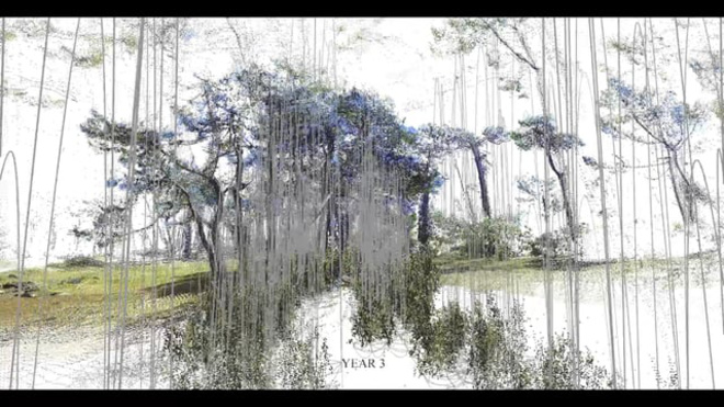


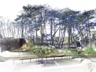


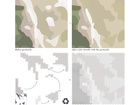
EVOLUTION THROUGH TIME
Two different rhythms of change
The two diferent layers (history/erosion) of the structure evolve in different ways. While the history layer made of permanent components has plants continually growing in them, the erosion layer made of ephemeral components change following the nature depending on the weather and amount of people on site.

Year 0 - Right after the structure was applied to the landscape
Currently on site there is considerable erosion on the surface of the grey dune caused by trampling and worsen by the wind. The ephemeral geotextile is applied to protect the sand and allow new growth to reinforce the dune. A permanent geotextile stands where the trenches and railways of the WWII used to be, allowing the reading of currently disappearing major traces of history.
Year 1 - After episodes of humid weather
After one year, the erosion is becoming rarer thanks to ephemeral geotextile. Some areas appear to be greener where the ephemeral geotextile used to be, the plants that have grown stabilise the grey dune. The permanent geotextile following the path of historical traces has started to merge with nature.
Year 10 - After episodes of dry weather
After 10 years, some extra eroded areas appeared due to the dry weather not ideal for plant growth. Some areas where the ephemeral geotextile used to be can be recognised by denser and richer vegetation. The permanent geotextile constantly protecting the sand has fostered new plant growth and totally merge with nature. The colonisation of the geotextile by the new plants makes the geotextile almost invisible. Nature and architecture become one.
Research booklets
Gathering informations to have a deep understanding of the different subjects my thesis was borowing from has been a considerable part of my process. The document below gather my researchs and writtings about:
- Bego, France
- Evolving visions towards WWII bunkers (gathering testimonies and original photos)
- Textile logic, contextual data based computation & circular economy
- Gardens, cultural landscapes, ruins & museums